
The Virtual Discovery Loop Trail
October 15, 2020
by Katelyn Shaw, student intern
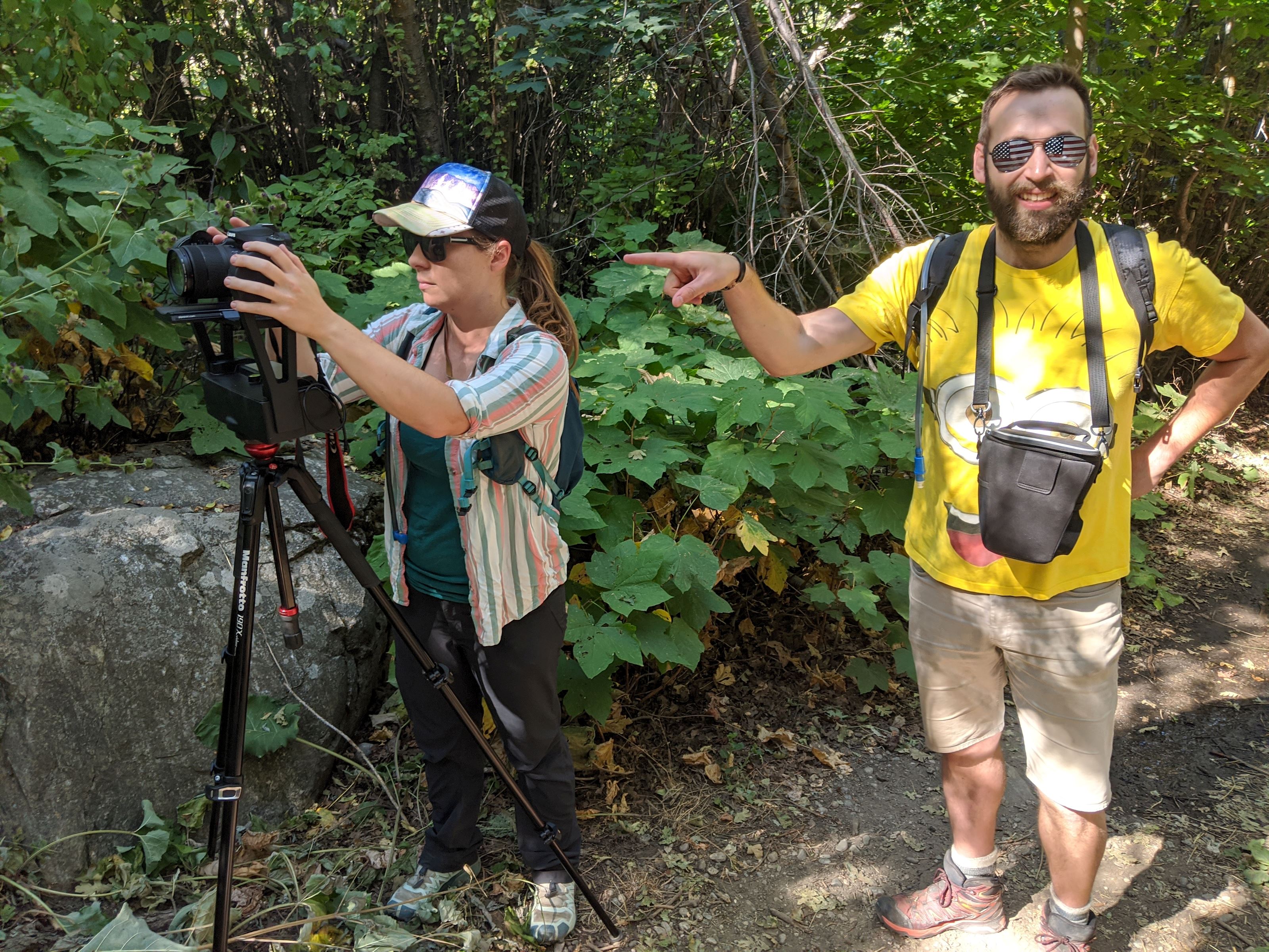
Dr. Elizabeth Balgord and Amanda Gentry discuss Weber State University Earth and Environmental Science department's efforts in creating virtual field trips.
 Faculty in the Weber State University Earth and Environmental Sciences department (EES) made virtual field trips of the Discovery Loop Trail for students and community members to learn from and enjoy.
The Discovery Loop Trail is a science-based trail that highlights the unique and different features of the Wasatch Front like vegetation, ancient shorelines, perched aquifers and landslides. The Discovery Loop Trail differs from other Utah hiking trails because of the informational signs placed along the 1.5 miles of trail, which not only inform the viewers, but challenge their thinking as well. Amanda Gentry, a Weber State professor and Science in the Parks director, said, "There are specific investigation stations that invite folks to have a hands-on experience with their surroundings. From building a mountain out of sand and rocks to finding fish in Strong's Canyon, each sign is designed to help hikers further explore the place they call home."
Dr. Elizabeth Balgord, a Weber State geosciences professor, used a digital camera and a panoramic camera mount to accomplish the 360-degree imaging. With this setup, pictures were taken in all directions at 15 different locations along the trail. Each location required 48 pictures, which took about six minutes, so the entire process lasted almost five hours. The phones were then stitched together with the help of the Weber State Creative Academic Technologies Solutions (CATS) team, who edited the photos and put them into the tour software. In the future, the department plans to add assignments to go with the tours that can be used by Weber State's faculty for general education classes or by K-12 educators in the community.
 The 360-degree Imaging process was used because it allows people to view and explore the content on their own. Pictures are necessary and important in field work to record the observed data, but they miss details that would give the viewer an accurate interpretation. With the 360-degree imaging, viewers are able to look all around the area and even zoom to view details. "The 360 technology really allows students to feel like they are in the location and moving along the trail," Balgord said.
This technology also allows users to study the field before actually traveling there. "This is particularly useful if a teacher would like to take his/her students on a field trip," Gentry said.
The project was initially started for Weber State students to take geoscience field trips, but after the main sites were recorded, more were added in an effort to connect and provide outreach with the local community.
The virtual field trips are easy to use; to move the image, simply click and drag the cursor around. If there is something in any of the photos that viewers would like more information about, Gentry encourages them to send an email (amandagentry@weber.edu), so they can include a call-out button with the requested information along with pictures and links. The main resources to access the images and website are still being completed, but you can view a sample image on the College of Science Facebook page.
COS Facebook BACK TO BLOG HOME