Dr. Elizabeth A. Balgord
Education
Ph.D. at the University of ArizonaM.S. at Idaho State University
B.S. at University of Wisconsin -Eau Claire
Contact Information
Room 331, Mail Code 2507
Courses
Refer to the course catalog for course descriptions.
GEO 1110 and 1115 Physical Geology, Dynamic Earth Lecture and Lab
GEO 1030 Earthquakes and Volcanoes
GEO 1220 Earth History
GEO 3060 Structural Geology
GEO 3550 Sedimentology and Stratigraphy
GEO 4060 Geoscience Field Methods
GEO 4510 Geology Field Camp (WSU Director)
GEO 2050/4050 Geoscience Field Trips (Iceland, Yellowstone, Bryce Canyon)
Teaching Philosophy
 The beauty of Earth science is that we can learn from everything around us. Geology controls where, how, and what we can build. In my courses, I strive to use real-world examples with a local emphasis to help my students connect with materials and concepts. Depending on a student’s background, the field can either be a draw or a barrier to entry. I worked with my colleagues in the department and CATS to generate virtual field trips to help introduce students to the landforms that surround them and get them thinking like a field scientist. I specialize in sedimentology, structural geology, and field mapping, so I teach all of those courses along with our introductory physical geology classes, depending on the semester.
-Photo from Geology Field Methods (GEO 4060) where students are learning about the geology of Ogden Canyon-
 Field trips start on campus, during lab periods, and will eventually expand to long weekends and week-long trips. Students will learn how to read landscapes and understand how the geologic evolution of the region controls geologic resources, from economic metals to drinking water, along with geologic hazards like earthquakes, landslides, and floods.
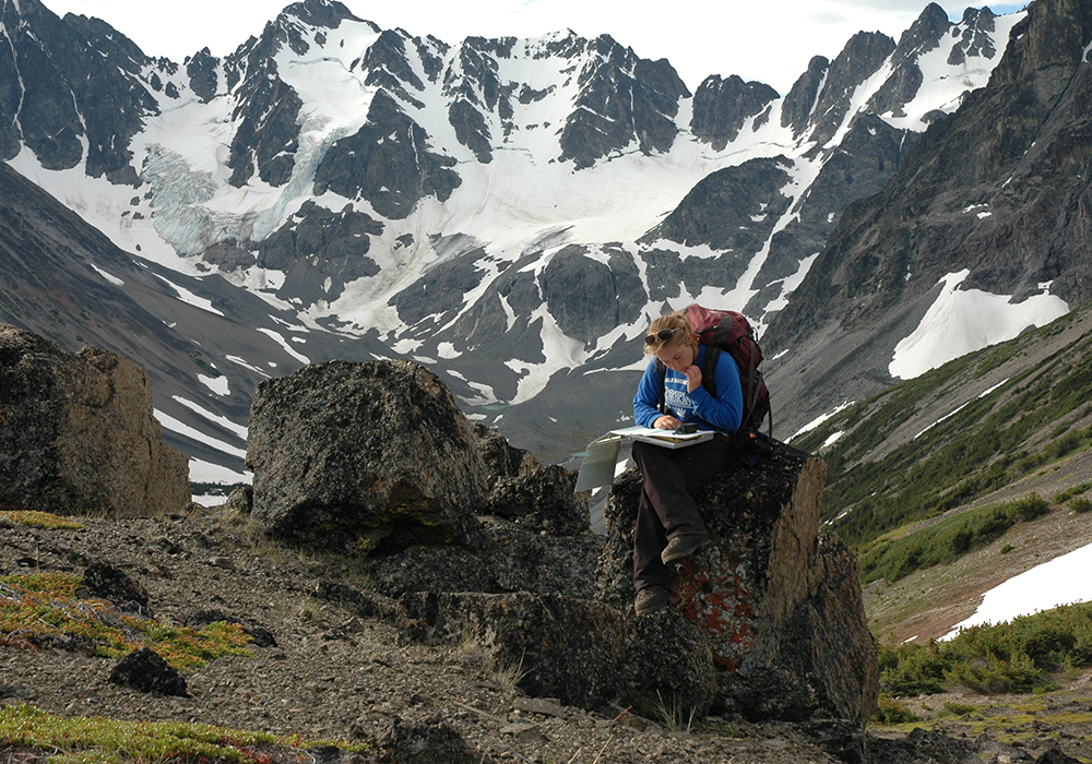
-Photo from Antelope Island when Dr. Balgord was working with her student, James Henderson, on the Virtual Tour of Buffalo Point-

-Photo from Valley of Fire State Park near Las Vegas, NV-

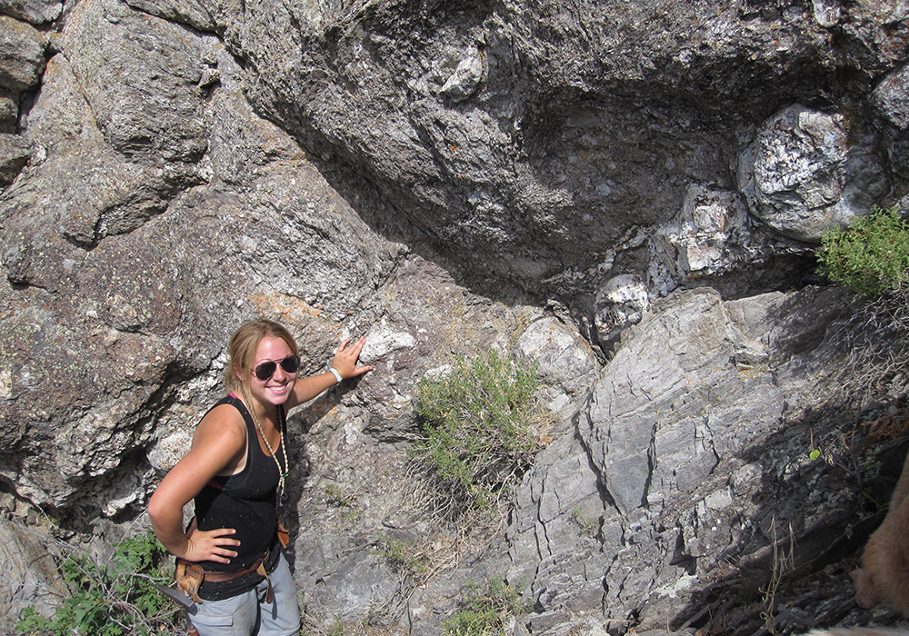
-Photo of Dr. Balgord teaching students about imbrication near Salt Lake City, UT-
Research Focus
I am a regional geologist who specializes in sedimentology, structural geology, and geo-thermochronology. Much of my work is centered on geologic mapping in the mountain ranges of western North America (Utah, Wyoming, Montana, British Columbia, the Yukon Territory) and South America (Mendoza, Argentina, and Ancash, Peru). I have worked extensively with the Utah Geological Survey to develop 1:24,000-scale maps of the northern Wasatch Mountains. Those maps are vital to state, regional, and city planners to determine geologic hazards and the potential for economic resources in our area. Geologic mapping requires an understanding of the entire geologic history of the region, from 2.45 billion-year-old metamorphic basement evolution to modern activity on the Wasatch Fault. My expertise in stratigraphy and geochronology has been put to work on everything from Precambrian basement to Miocene volcanic deposits. Many of these projects have involved WSU undergraduates who worked with me both in the field and lab to better understand our surrounding geology.
.jpg)
Lomond Mountain just north of Ogden. This photo was
taken by UGS mapper, Adam McKean, while they were
working on the geologic map of the North Ogden Quadrangle-
Along with work in the field, my research integrates multiple laboratory techniques, including petrography, geochemistry, and geochronology. I helped build and organize our rock crushing and mineral separation facilities, located in 111 and 103 on the first floor of the Tracy Hall Science Center. I also collaborated with faculty members in Physics and Chemistry to procure a new cathodoluminescence (CL) detector for the scanning electron microscope (SEM) with the support of a National Science Foundation Instrumentation and Facilities Grant. I use the CL to image zircon minerals separated from various rocks. Imaging is vital to assess internal morphology before determining the age of the minerals. I also use whole-rock geochemistry facilities in TY 215 for both course-based and independent student research projects.

Research Projects and Students Mentored
(Publications associated with projects are listed after project descriptions. An asterisk indicates a student author.)
Cenozoic Volcanic Deposits in Ogden and Morgan Valleys (Ben Cornwall and Ethan Mayfield)
.jpg) The Norwood Tuff is an Eocene volcaniclastic package present in the Ogden and Morgan valleys of northeastern Utah. The age of the Norwood Tuff was previously constrained using K-Ar and mammalian paleontology techniques, and was potentially correlated with the Keetley Volcanics to the south. However, previous ages are based on outdated techniques and are spatially and stratigraphically limited. We collected and analyzed a range of samples for zircon U-Pb geochronology within the type section in Norwood Canyon (n=8), and an equivalent package in Porterville to the west (n=11), covering ~8 km from west to east and at least four separate stratigraphic intervals. Zircon U-Pb ages were obtained using LA-ICP-MS at the Arizona Laserchron Center, and a subset of additional grains was targeted for Hf isotopic and trace element analysis. We complement these analyses with detailed sedimentological descriptions of the units, thin section petrographic, and whole rock geochemical analysis. Preliminary results indicate that the unit previously mapped as the Norwood Tuff contains strata deposited during at least three separate volcanic intervals, between 42 and 40 Ma, 22 Ma, and ~9 Ma.
The Norwood Tuff is an Eocene volcaniclastic package present in the Ogden and Morgan valleys of northeastern Utah. The age of the Norwood Tuff was previously constrained using K-Ar and mammalian paleontology techniques, and was potentially correlated with the Keetley Volcanics to the south. However, previous ages are based on outdated techniques and are spatially and stratigraphically limited. We collected and analyzed a range of samples for zircon U-Pb geochronology within the type section in Norwood Canyon (n=8), and an equivalent package in Porterville to the west (n=11), covering ~8 km from west to east and at least four separate stratigraphic intervals. Zircon U-Pb ages were obtained using LA-ICP-MS at the Arizona Laserchron Center, and a subset of additional grains was targeted for Hf isotopic and trace element analysis. We complement these analyses with detailed sedimentological descriptions of the units, thin section petrographic, and whole rock geochemical analysis. Preliminary results indicate that the unit previously mapped as the Norwood Tuff contains strata deposited during at least three separate volcanic intervals, between 42 and 40 Ma, 22 Ma, and ~9 Ma.
Photo: Students, Ethan Mayfield (left) and Ben Cornwall (right), take notes and collect samples from the Eocene Wasatch Formation on the southern end of Morgan Valley on the eastern side of the Wasatch Mountains.
Publications:
*Cornwall, B., *Mayfield, E., Balgord, E., Yonkee, A., Perez Consuegra, N., Wilfong, C., Anderson, Z., McKean, A. and McDonald, G., 2025, Revised Age and Geologic Significance of the Norwood Tuff, Morgan Valley, Northern Utah: Provo, UT, May 19, Geological Society of America Abstracts with Programs. Vol. 57, No. 5, doi: 10.1130/abs/2025RM-410158
*Mayfield, E., *Cornwall, B., Balgord, E., Yonkee, A., Perez Consuegra, N., Wilfong, C., Anderson, Z., McKean, A. and McDonald, G., 2025, Revisiting the Norwood Tuff: Unveiling Yellowstone Hotspot Ashes in Ogden Valley, Northern Utah: Provo, UT, May 19, Geological Society of America Abstracts with Programs. Vol. 57, No. 5, doi: 10.1130/abs/2025RM-410187
Neoproterozoic to Cambrian Evolution of Western Utah (Kara Olsen with Arturo Barron and Erendira Sanchez from the University of Sonora)
 Thick successions of Neoproterozoic (1000-540 million years ago) to early Cambrian (585-540 million years old) sedimentary rocks exposed in the northern Wasatch Range in Utah contain the record of extreme tectonic, climatic, and biological events. These include the rifting of a supercontinent, global glaciations, and the proliferation of multicellular life. Although general rock types and correlations have been established for the area, depositional ages, spatial and temporal variations in provenance, and tectonic and setting are incompletely understood. Additionally, there have been no Ediacaran (535-542 million years ago) fossils recorded in these sections, even though they are the same age as important fossil beds globally, recording the expansion of soft-bodied multicellular life immediately before the major diversification of hard-bodied multicellular life in the Cambrian. Thus, fundamental concepts of the history of North America, such as rift timing, paleogeographic evolution of the margin, and the interrelations between tectonic and biological changes globally, remain incompletely understood.
There are world-class exposures of late Neoproterozoic (Ediacaran) rocks exposed in the northern Wasatch Mountains, Ogden Valley, and the Bear River Range. I am working on a joint study with other WSU faculty, researchers at Utah State University, and the Utah Geological Survey to map, describe, date, and interpret those units in Ogden Valley. The goal of this project will be to describe these units in detail, work to identify fossils within the stratigraphy, collect samples for geochemical and geochronologic analysis, and correlate them with equivalent sections around the world.
Photo: Researchers Arturo Barron and Erendira Sanchez looking at rocks from the Brown Hole Formation near Powder Mountain Ski area in northern Utah.
Publications:
Balgord, E., Yonkee, A., Weil, A., Wells, M., 2024, Influence of Neoproterozoic to Paleozoic stratigraphic architecture on tectonic evolution of the Sevier and Laramide belts, Geological Society of America Abstracts with Programs, v. 56, n. 5.
*Sanchez, E., Barron, A., Balgord, E., Yonkee, A., Hagadorn, J., 2024, Petrogenesis of the Ediacaran Browns Hole Formation of northern Utah: Geological Society of America Abstracts with Programs, v. 56, n. 5.
Barron, A., Balgord, E., Yonkee, A., *Sanchez, E., Paz-Moreno, F. A., Holm-Denoma, C., Hagadorn, J., 2024, The Neoproterozoic Rifting of Western Laurentia: a Single Event or Two Rifting Processes?: Geological Society of America Abstracts, v. 56, p. 405473
Paleoproterozoic Petrotectonic Evolution of Western North America (Alex Giacomo, Analeah Vaughn, Brooklyn Smout, Keilee Higgs, Marshall Wayment, Alexander Bernich, Austin Jensen, Saige Carter, Elizabeth Williams, James Henderson, Kristi Rasmussen, Lauren Wilcock, Roxolana Athalye, Nicholas Bentley, Bart McDonald, Jon Henriod)
 The Farmington Canyon Complex (FCC) comprises Precambrian igneous and metamorphic rocks exposed that record continent growth during the tumultuous Paleoproterozoic Era (spanning 2.5-1.6 billion years old (Ga)). The transition from the older Archean to Paleoproterozoic Era at 2.5 Ga marks perhaps the most fundamental change in Earth systems, with the growth of the first supercontinents, the possible onset of plate tectonics, the initial rise of atmospheric oxygen, and rapid shifts in global climate (first ‘Snowball Earth' glaciation). The FCC also lies between multiple Archean and Paleoproterozoic craton blocks, providing a critical link for understanding how crustal collisions formed ancestral North America. Although general rock types within the FCC have been described, including granitic gneiss, amphibolites, and paragneiss that formed from metamorphism of granite intrusions, mafic (basalt) dikes, and sedimentary rocks, respectively (Bryant, 1988; Yonkee et al., 2000), the geologic significance of these rocks remained incompletely understood. Prior geochronologic (geologic dating) for parts of the FCC indicated a complex history, with inherited Archean components, multiple phases of igneous intrusion, and Proterozoic metamorphism. However, large parts of the FCC remained undated and poorly understood geochemically. These limitations led us to begin a systematic study of the FCC, which is ideal for involving undergraduate students in research.
 Photos: 1) Students and faculty working on the southern end of Antelope Island in the Great Salt Lake, collecting samples of the Farmington Canyon Complex. 2) Students (from left to right) Nicolas Bentley, Kristi Rasmussen, Roxolana Athalye, and Laura Wilcock hold samples of the Farmington Canyon Complex next to one of their posters from WSU Student Research Day.
Publications:
Balgord, E., Yonkee, A., *Henriod, J., *Olsen, K., *Knight, L., *Tanner, N., Rabosky, K., 2024, Age, Provenance, and Hf isotopic signatures of the Farmington Canyon Complex, Northern Utah: Implications for Paleoproterozoic crustal evolution of western Laurentia: Geological Society of America Abstracts with Programs, v. 56, n. 4. doi: 10.1130/abs/2024CD-399838
Balgord, E. A., Yonkee, W. A., *Wilcock, L., 2023 Unraveling the Paleoproterozoic evolution of western North America: petrotectonic, geochemical, and geochronologic studies of the Farmington Canyon Complex, northern Utah: Geological Society of America Abstracts with Programs, v. 55, n. 5
*Wilcock, L., *Rasmussen, K., Balgord, E. A., Yonkee, W. A., 2022, Age, Protoliths, and Petrotectonic History of the Farmington Canyon Complex: Paleoproterozoic Evolution of Western North America: Geological Society of America Abstracts with Programs, v. 54, n. 5
*Rasmussen, K., *Wilcock, L., *Athalye, R., Balgord, E., Yonkee, A., 2022, Age and Evolution of the Farmington Canyon Complex, Northern Utah: Insights from U-Pb Zircon Geochronology: Geological Society of America Abstracts with Programs, v. 54
*Jensen, A., Balgord, E. A., *Berniche, A., Potter, K., Kobe, S., Yonkee, A., 2020, Petrotectonic Evolution of the Precambrian Farmington Canyon Complex of Northern Utah: Geological Society of America Abstracts with Programs, v. 52, n. 6.
Economic Mineralization in the Silver Island Mountains of Western Utah (Cole Stern, Logan Knight, Jonathan Shank, Chantelle Anderson, Elizabeth Williams, Kylie Arcias, Jackson Smith)
 The Silver Island Mountains, located in western Utah, bordering Wendover NV, contain the geologic record of at least 500 million years of the evolution of western North America. Additionally, there are zones of highly altered rocks and potentially valuable ore deposits. Paleozoic marine deposits and undated intrusive bodies have been identified and mapped throughout this area, as well as high-angle normal and transform faults, along with hydrothermal fluid alteration. The purpose of this project was to understand the timing, genesis, and evolution of mineralization (metal deposits) to assess the viability of economic deposits in the area. We dated three separate igneous units, including a ~150 million-year-old intrusive body, which has minor mineralization along its margins, and ~30 million-year-old shallow-level intrusion with minor copper mineralization, and young, 4.5 million-year-old volcanic deposits with no mapped mineralization.
Students presented this work at the Geological Society of America national meeting in Pittsburgh, PA, and the work has been shared with the Utah Geological Survey to help with ongoing map projects.
Photo: Students, Jonathan Shank (left) and Logan Knight (right), looking at claim stakes in their map area in the Silver Island Mountains.
Publications:
*Knight, L., *Olsen, K., *Shank, J., *Stern, C., Balgord, E., 2023, Timing and genesis of mineralization in the Silver Island Mountains, western Utah: Geological Society of America Abstracts with Programs, v. 55, n. 6
Mesozoic-Cenozoic Development of the Central North American Cordillera (Angela Jex; Andrea Stevens Goddard and Sophie Black from the University of Indiana and Bloomington)

Stratigraphic and structural relations of synorogenic strata deposited in basins in northern Utah constrain the timing, location, and magnitude of mountain building. This project combined new geologic mapping, conglomerate clast counts, sandstone grain point counts, and detrital zircon data from proximal Cretaceous to Paleogene sedimentary units deposited just east of Salt Lake City, near Little Mountain, UT. New mapping has identified four distinct conglomeratic packages in the study area that were previously mapped mostly as the Tertiary Wasatch Formation. New unit identification is primarily based on changes in conglomerate clasts that have also been identified in correlative strata to the east. Conglomeratic units overlie Paleoproterozoic basement and folded Paleozoic-Jurassic rocks in the Wasatch Mountains with angular unconformity, and comprise from base to top: (i) proximal facies of the Aptian to Turonian Kelvin and Frontier Formations; (ii) coarse conglomerates with local grown relations along the East Canyon backthrust correlated with the Echo Canyon and Weber Canyon Conglomerates; (iii) boulder conglomerate above an unconformity that thickens northward and is interbedded with finer-grained strata correlative with the Maastrichtian-Paleocene Evanston Formation; and (iv) polymict conglomerate with lenses of lacustrine limestone correlative with the Eocene Wasatch Formation. Preliminary U-Pb geochronologic analysis of detrital zircon in samples of synorogenic strata shows “classic” North American zircon populations originally sourced from the Yavapai-Mazatzal, Mid-continent rhyolite, Grenville, and Appalachian basement provinces, along with an apparent lack of Cordilleran arc-sourced grains. Patterns are consistent with unroofing of multiple stratigraphic levels across frontal and piggy-back thrust sheets, recycling from erosion of previously deposited synorogenic strata, and development of a topographic barrier along the Wasatch anticlinorium that separated the foreland basin in this area from sources in the hinterland to the magmatic arc, whereas arc-sourced grains are common in correlative synorogenic strata farther north and south.
New work with collaborators from the University of Indiana has shown that much of the sand within the Paleozoic and Mesozoic rocks in the northern Wasatch Mountain originated in the Appalachian Mountains far to the east while they were at their highest. U-Th/He dating allows us to determine the timing of uplift of the Appalachian Mountains by looking at sediments deposited in Utah.
Photo: Andrea Stevens Goddard (left) and Sophie Black (right) from the University of Indiana collecting samples and doing field work with Dr. Balgord just east of Salt Lake City, near Little Mountain, UT.
Publications:
Stevens Goddard, A., *Black, S., Balgord, E., Anderson, Z., Leary, R., Thurston, O., Yonkee, A., 2025, Detrital thermochronology histories preserved in Paleogene strata of Utah provide distant records of Paleozoic Alleghenian orogenesis and sediment dispersal: Geology, v. 53, n. 3, pp. 217-222
*Black, S., Stevens Goddard, A., Balgord, E., Anderson, Z., and Yonkee, A., 2022, The Importance of Local Provenance Variation in Foreland Basin Systems: Sevier Fold-Thrust Belt, Eastern Wasatch Range of Northeastern Utah: Geological Society of America Abstracts with Programs, v. 54, n. 5
Goddard, A. S., Balgord, E., *Black, S., Anderson, Z., Yonkee, A., & Thurston, O. 2023, Record of Late Paleozoic Exhumation of the Appalachian-Ancestral Rockies orogenic system preserved in recycled clasts in the Sevier Foreland Basin: American Geophysical Union Annual Meeting
Balgord, E., Anderson, Z., Yonkee, A., Stevens Goddard, A., *Black, S., 2022, New Mapping, Stratigraphic and Provenance Analysis of Cretaceous-Paleogene Conglomerates in Northern Utah: Geological Society of America Abstracts with Programs, v. 54, n. 5
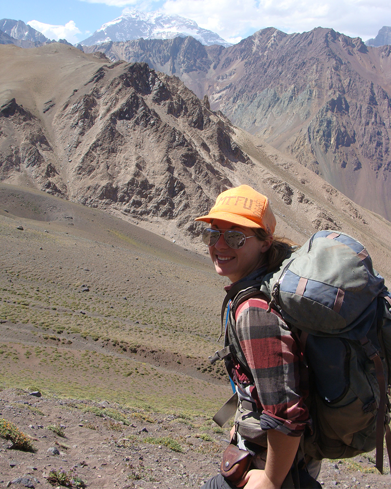
Mesozoic Evolution of the Aconcagua Region of Central Argentina (Prof. Nicolas Perez Consuegra)
.jpg)
The Andes Mountains, at over 7000 km long, are the longest mountain chain on Earth and contain the highest peak (Cerro Aconcagua: 6962 m) in the western and southern hemispheres. Located on the east side of the Pacific Ring of Fire, well known for earthquakes, volcanoes, and tsunamis, the Andes are a constant reminder of the ongoing collision between the various fragments of the Pacific plate and South America. Uplift within the Andes is temporally and spatially variable, leading to questions regarding the underlying controls of the rate and timing of mountain building. Near the base of Cerro Aconcagua, 250- to 65-million-year-old rocks contain evidence of the onset of compression and uplift within this section of the Andes. However, the exact timing and the magnitude of different uplift events have not been quantified, making it impossible to determine these rates over time. This study will apply cutting-edge techniques, including laser ablation and fission track analysis, to precisely determine the timing and amount of initial uplift of the rocks in the field area, allowing for more accurate paleogeographic reconstructions and direct comparisons to modern shortening rates. A detailed understanding of the regional geology is necessary to fully assess the potential for and extent of natural resources and geologic hazards.
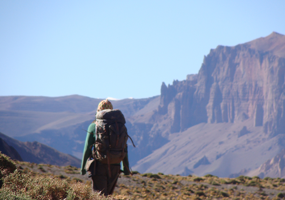
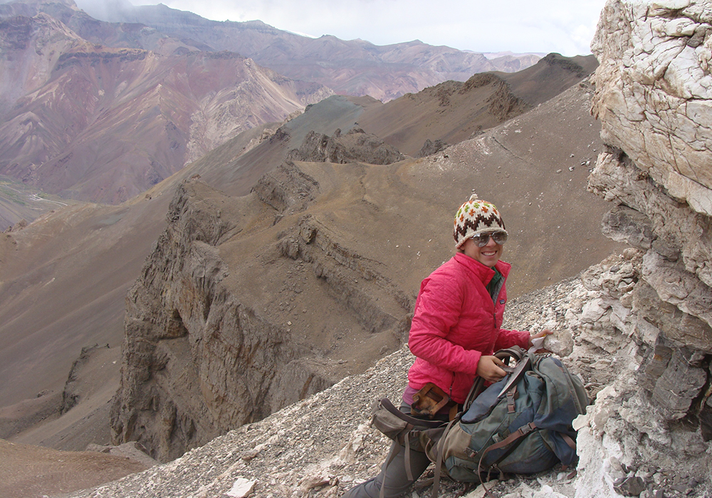
Photo: Perez Consuegra and Balgord on the summit of Cerro Bonete with Cerro Aconcagua in the background.
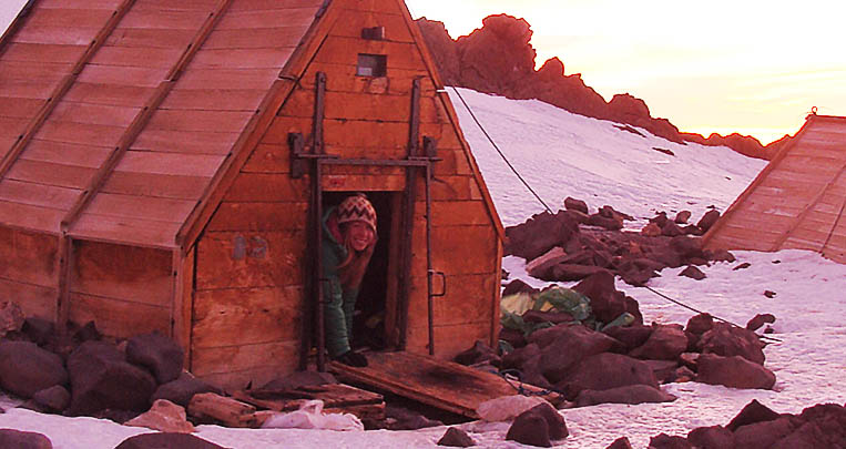
The Impact of Glacial Retreat on High Alpine Watersheds in the Cordillera Blanca, Peru (Daksha Patel, Carmen Longo, Analeah Vaughn)
The Cordillera Blanca, in Peru, contains the highest concentration of tropical glaciers in the world and is the highest-elevation section of the northern Andes Mountains. The low latitude of the Cordillera Blanca makes the glaciers more susceptible to the overall warming trend over the past few decades, and the region has been experiencing rapid deglaciation. The extreme topography of the Andes Mountains also generates a rain shadow, making the western, much more populated portion of Peru a desert. Therefore, glacial runoff and snowmelt from the mountains are the primary source of freshwater for the western portion of Peru, so water quality and quantity coming out of the Cordillera Blanca are crucial both locally and nationally. As the glaciers recede, a zone of heavily mineralized rock is being exposed. This rock contains pyrite and other sulfide minerals, which cause water contamination. I worked with students to map drainages within the Cordillera Blanca to identify the extent of the mineralized zone and assess the control of bedrock geochemistry on water chemistry. This mapping has allowed us to predict where water contamination may get worse as the glaciers continue to recede. This project is part of an interdisciplinary project to document the impact of climate change on high alpine ecosystems. Along with the research aspect, this project also includes a class for undergraduate students to learn how to conduct scientific field research in challenging settings. This work was presented by students at multiple professional meetings.

Photo: Balgord collecting snow samples with another member of the American Climber Science Program on the descent from Cerro Ishinca in the Cordillera Blanca.

Photo: Mapping with students Carmen Longo and Analeah Vaughn.

Photo: The whole American Climber Science Program expedition group at Huapi Pass (16,404 ft) in front of Cerro Ranrapalca (20,217 ft) in the Cordillera Blanca, Peru.
Publications:
*Williams, B. E., Diedesch, T. F., Balgord, E. A., All, J., 2020, Geologic Mapping of Sulfide-Bearing Bedrock Exposed by Deglaciation in the Cordillera Blanca, Peru: Geological Society of America Abstracts with Programs, v. 52, n. 2
*Vaughn, A., Balgord, E. A., Diedesch, T. F., All, J., Sofield, R., 2019, Tracking Glacial Retreat in the Peruvian Andes: Geologic Mapping in the Cordillera Blanca Documents Newly Exposed Sources of Water Contamination: Geological Society of America Abstracts with Programs, v. 51, n. 5.
*Morgan, C., Diedesch, T. F., Balgord, E. A., 2019, Deformation and Metamorphism in the Roof of the Cordillera Blanca Batholith, Peru: Geological Society of America Abstracts with Programs, v. 50, n. 41
*Longo, C., Balgord, E. A., Diedesch, T. F., All., J., 2018, The Impact of Climate Change of Water Quality in the Cordillera Blanca, Peru: Geological Society of America Abstracts with Programs, v. 50, n. 6
*Patel, D., Balgord, E. A., and All, J., 2017, Bedrock Geochemistry and its Control on Water Quality during Rapid Glacial Retreat in the Cordillera Blanca, Peru: Geological Society of America Abstracts with Programs, v. 49, n. 6.