

CARES Funding Supports Students in WSU’s New Geospatial Technology Certificate Programs
OGDEN, Utah – Twenty Utah residents aiming to expand their employment opportunities amid the COVID-19 pandemic will gain a new skill set in geospatial technology at Weber State University this year – free of charge.
In one academic year, these students will earn one of Weber State’s two certificates in geospatial technology: one entry level and the other advanced. Most students in the group will be working toward the advanced certificate, but either credential will make them hireable in the field after only two semesters of coursework, said Eric Ewert, Weber State professor of geography and department chair.
.jpg) With the support of $139,000 in federal CARES Act funding, Weber State’s Northern Utah Geospatial Technology Education Program (NUGeoTec) awarded each of the students a scholarship of about $6,200, which will cover their tuition, fees and supplies for the year.
With the support of $139,000 in federal CARES Act funding, Weber State’s Northern Utah Geospatial Technology Education Program (NUGeoTec) awarded each of the students a scholarship of about $6,200, which will cover their tuition, fees and supplies for the year.
“It should cover everything,” Ewert said. “There will be no out-of-pocket money for any student.”
Utah has put a portion of the state’s CARES Act funding toward retraining people displaced by COVID-19 through the “Learn & Work in Utah” initiative – but colleges and universities had to compete to receive part of the funding, Ewert said. NUGeoTec was one of eight programs at Weber State selected to receive portions of the funding after applying at the state level.
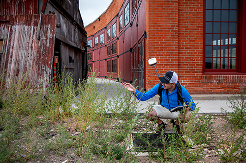
NUGeoTec’s certificate programs in geospatial technology teach digital mapmaking, airborne and satellite imagery and global positioning and navigation systems (GPS), as well as the software used to analyze and interpret geospatial data, called geographic information systems (GIS). The program’s entry-level Geospatial Technician Certificate trains students to use and apply the technology, while the advanced Geospatial Analyst Certificate equips them with the skills to create it, he said.
“It’s running everywhere, and you don’t even know it,” Ewert said of geospatial technology. “It’s on your phone right now. Any time you look at traffic or try to find a restaurant nearby, geospatial technology is what does that.”
The same goes for booking a plane flight or requesting an Uber or Lyft ride, he said, though the technology is applied more broadly, from assessing snowpack for ski resorts to mapping cases of COVID-19 to identify transmission hot spots. Because geospatial technology is used across fields, job prospects are good for an entry-level certificate, Ewert said.
Timber Erickson, a geography major in his final semester at Weber State, has first-hand experience with success in the geospatial technology job market. Though he hasn’t yet completed a certificate, after only a few courses in geospatial technology during his first year of college, Erickson landed a summer job as a part-time GIS specialist for the city of Evanston, Wyoming. He’s continued in the job since then, making more money than he would in most student jobs and gaining valuable skills along the way.
As a GIS specialist, Erickson has mapped out underground water utilities, so it’s easier to make repairs, completed topographic surveys for the city’s engineering department and helped the city planner create zoning maps. He’s also on track to graduate with an advanced certificate in geospatial analysis.
The market for these skills is growing, he said.
“More municipalities and government agencies are realizing that GIS is something they need — that will optimize efficiency and workflow,” Erickson said. “As soon as the scholarship students get the year’s worth of experience in school, they can really find a decent job to provide for themselves or their families.”
 Erickson has seen job postings in northern Utah that offer $20 an hour or more, requiring only a certificate and a high school diploma, he said.
In addition to his job with Evanston, Erickson has done GIS work for the Weber State Facilities Management department. He’s also working on a thesis project mapping dead deer, elk and moose along high-speed roads in northern Utah to find the best location for a wildlife overpass, which would allow the animals to safely migrate without crossing busy roads, he said. He is using data supplied by the Utah Department of Natural Resources for the project, and when he has completed it, he will provide the department with his findings.
Erickson’s varied experience has made for an easy transition to full-time work. He’s already accepted a full-time position with Evanston when he graduates in December. This is just the type of scenario Weber State aims to support by offering “stackable” certificate and degree programs, which allow students to enter the workforce and gain experience while continuing to earn an associate’s or bachelor’s degree.
The certificate programs are also part of Weber State’s dual mission as a regional university and community college, Ewert said. The programs serve people of all education levels, from high school to college graduates, and they give students the option to enter the workforce after earning a certificate or continue on toward a degree, he said.
NuGeoTec was created almost six years ago with grant funding from the National Science Foundation. This funding was used to develop Weber State’s geospatial technology certificates, which are aligned with the U.S. Department of Labor Geospatial Technology Competency Model, a nationally recognized standard. While courses in geospatial technology have been offered at Weber State for many years, the certificates were first offered in fall 2019.
For more news about Weber State University, visit weber.edu/wsutoday.
Megan Olsen, Office of Marketing & Communications
801-626-7948 • meganolsen9@weber.edu- Contact:
Eric Ewert, Department of Geography professor and department chair
801-626-6197 • eewert@weber.eduTimber Erickson, Department of Geography and NUGeoTec student
307-409-5674 • timbererickson@mail.weber.edu